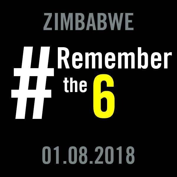
 In this update, made on the sombre anniversary of 1st August 2018 when Zimbabwe's Soldiers opened fire indiscriminately on unarmed civilians - who were quite correctly protesting about the rigging of the 2018 election, we must remind all Zimbabweans, the AU [African Union], SADC [Southern African Development Community] and the rest of the World, that there are currently NO Free and Fair Elections - nor has there been in practice since the 1980 [False] Independence. We will also repeat this item on our website that highlights the fact that there is a Military Cabal controlling Zimbabwe, the Zanu PF party. https://take2zimbabwe.com
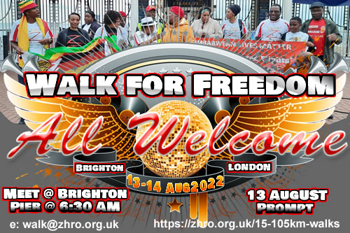 So our WALK FOR FREEDOM is as relevant as ever on this 7th time we have planned this event [the first time was in August 2016 just prior to the formation of ZHRO in October 2016]. Our 'practice walks' this month in London and North Yorkshire, have tied-in with other events to do with campaigning for Free, Fair and Open Elections - as highlighted below:
"Everyone has the right to take part in the government of his country, directly or through freely chosen representatives. . . . The will of the people shall be the basis of the authority of government; this will shall be expressed in periodic and genuine elections which shall be by universal and equal suffrage and shall be held by secret vote or by equivalent free voting procedures."
Article 21, Universal Declaration of Human Rights, 1948
As in previous year's we will attempt to predict our walking timetable for those who may wish to cheer us on, or join us for part of this well trodden route of ours. So we will publish maps, timetables, and for those with a 'tech savvy' outlook - live navigation links to the UK's Ordnance Survey Mapping software. The same as the organiser's on the day. {Due shortly}
This year we are actively seeking supporting donations so that we can [as we have done in every year previously] have a support team(s) to ferry the walkers, food, bandages, blister plasters etc., In addition as necessary, finally collect the "walking wounded" (!) - joking - but some of us have very delicate feet - and the stony footpaths can take their toll on those without practice, multiple pairs of socks {for keeping the feet cool}, good footwear, ankle support, blisters and cramps! Plus a bit of sympathy at times too!
 So our donation PayPal button on this page would welcome your spontaneous generosity. Or this QR code using your phone.
Now those wishing to be at the start, we must emphasise that the walkers will hope to leave the Brighton Pier forecourt at 7:00am sharp. This is to facilitate the 8 miles to stand and take in the stunning beauty atop the "Devil's Dyke" hill within the South Downs.
As the organisation is very 'minimal' we cannot accommodate people leaving at different times - as each group would need navigational support - since so few have taken onboard the mapping software in the past. So for practical reasons, we start at one time, in a group, ideally keeping together. This will facilitate the taking of photos, Twitter, Facebook, ZHRO Live, Zim Eye Live and other media we will employ throughout the full 25-30 hours of the "Walk for Freedom"
This link is the most important, its the original detailed full route as plotted on the OS Online platform from Ordnance Survey UK. It is scaleable, in that it can be enlarged right down to individual footpath levels. If you have the OS App then you can navigate "live" in the field using your phone as a direction finder. 100km Route CLICK HERE
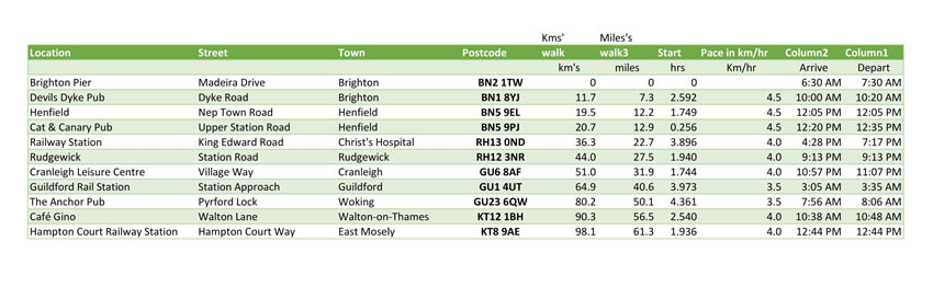
Timetable {Approximate}
| This timetable is AN APPROXIMATION for arriving and leaving times at the locations identified with Sat Nav Post Codes |
 |
Route Maps here - Along the full Walk for Freedom
| These Short Section Maps are designed to help those without Data Access "In the field" as it were. Please print off the section(s) you will be walking | |
| USE THESE LINKS Opposite TO OPEN THE MAPS in a new Window | Itemised Map Links |
| Brighton Start: BN2 1TW | Brighton and suburbs |
| Crossing the A27 | Cross A27 |
| Towards Devil's Dyke: BN1 8YJ {Public House} | Towards Devil'd Dyke |
| Fulking Villiage | Down to Fulking Villiage |
| Crossing the Vale | Crossing the Vale |
| On to Henfield: BN5 9PJ | On to Henfield |
| Joining the "Downs Link" [An old Railway Route to Guildford] | Joining the Downs Link |
| Partridge Green | Partridge Green |
| Christ's Hospital Railway Station: RH13 0ND | Christ's Hospital |
| Scaling the Hill over the "Bat Tunnel" | The BAT Tunnel |
| Approaching Guildford {Night Time} | Approaching Guildford |
| Central Guildford incl Railway Station Meet Point GU1 4UT | Guildford Area |
| Now with the River Wey Path | Leaving Guildford area |
| Keeping with the River Wey Navigation Path | River Wey Navigation |
| Under the M25 [into London!] | Under the M25 |
| Meeting with the River Thames Path | Joining Thames Navigation |
| Following the Thames Navigation footpath to Hampton Court | Hampton Court and Finish |
Ready for further Updates Here

